
Supplemental information on Walker River flow and depth can be accessed through the interactive USGS Walker Basin Hydromapper:
https://webapps.usgs.gov/walkerbasinhydromapper/#viewer
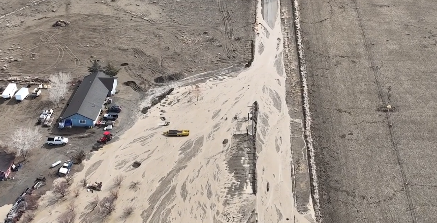
https://www.facebook.com/photo/?fbid=550318290530736&set=a.199761272253108
From the City of Yerington, Public Works at noon on 03/12/2023:
https://www.facebook.com/YeringtonNVPublicWorks/videos/224210703418290


More Stories
Nevada Current: Judge hits the brakes on land sale near polluted Anaconda site
Understanding Your City Utilities: Yerington, Nevada
7.14.26 – Lyon Co. Planning Commission Votes 4-3 to Recommend Monarch Data Center PUD Approval